
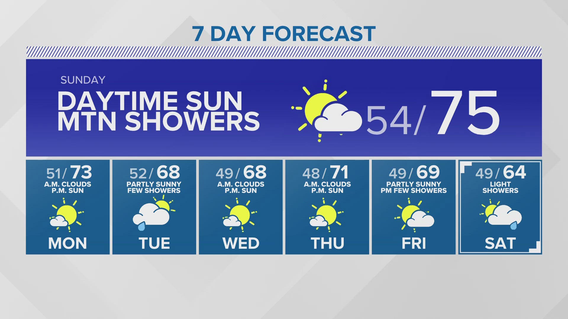
SEATTLE — Puget Sound Extended Forecast
Sunday: Morning clouds to afternoon sunshine. Chance of afternoon showers in the mountains. Morning lows in the mid to upper 50s. High temperatures in the upper 60s to mid-70s.
Monday: Morning clouds turning mostly sunny in the afternoon. Morning lows in the low to mid-50s. High temperatures in the upper 60s to low 70s.
Tuesday: Partly sunny with a chance of a few showers. Morning lows in the upper 40s to mid-50s. High temperatures in the mid to upper 60s.
Wednesday-Thursday: Morning clouds becoming mostly sunny in the afternoon. Morning lows in the upper 40s to mid-50s. High temperatures in the mid to upper 60s.
Friday: Dry to start then light shower chances by the evening. Morning lows in the upper 40s. Afternoon highs in the mid to upper 60s.
Saturday: Spotty showers. Morning lows in the upper 40s. Afternoon highs in the low to mid 60s.
Discussion:
Sunday will start cloudy around Puget Sound then clear to mostly sunny skies into the afternoon. A weak system brushes by to the east, bringing light shower potential to the Cascades and Eastern WA in the afternoon. A light shower is also possible around the Olympics and Hood Canal.
As we head back to work on Monday, we settle into a normal June pattern with morning clouds and afternoon sun through the first half of the week.
Another passing system from the northwest brings light showers during the day on Tuesday. Temperatures will cool to the mid to upper 60s by midweek.
Wednesday through Thursday will stay mild and feature morning clouds to afternoon sun with daytime highs hovering around 70 degrees.
More rain chances arrive by Friday evening into Saturday.